The engineering record for the assets a council holds for decades.
A council keeps drawings for its civic buildings, local roads, footpaths, and drainage, a record inherited across amalgamations and staff turnover and held by a small team. Lunr puts every drawing under revision control, keeps it searchable back through the scanned archive, and makes contractor handover arrive complete, so the people who inherited the record can find the right drawing and trust it is current.
10M+ documents under management · Hosted in Australia and the US · SAML · Full audit trail · Export anytime
Organised by civic building, road, and drainage asset.
A council holds drawings for its civic buildings, local roads, footpaths, and drainage across decades of works, and each asset carries its own set. Group every asset into a Portfolio, keep each drawing under revision control, and the superseded copy is never mistaken for the current one. When staff move on, the record stays, with a full audit log behind every change.
- Keep decades of drawings for civic buildings, roads, footpaths, and drainage under revision control.
- Group the assets into Portfolios by facility and network, each carrying its own asset information.
- Automatic document and version numbering, applied in your register format as records are booked in.
- A full revision history on every drawing, so any change can be traced and evidenced years later.
- Export all metadata, drawings, and models at any time, so the record stays with the council.
Portfolios · revision control · automatic numbering · audit log · export anytime
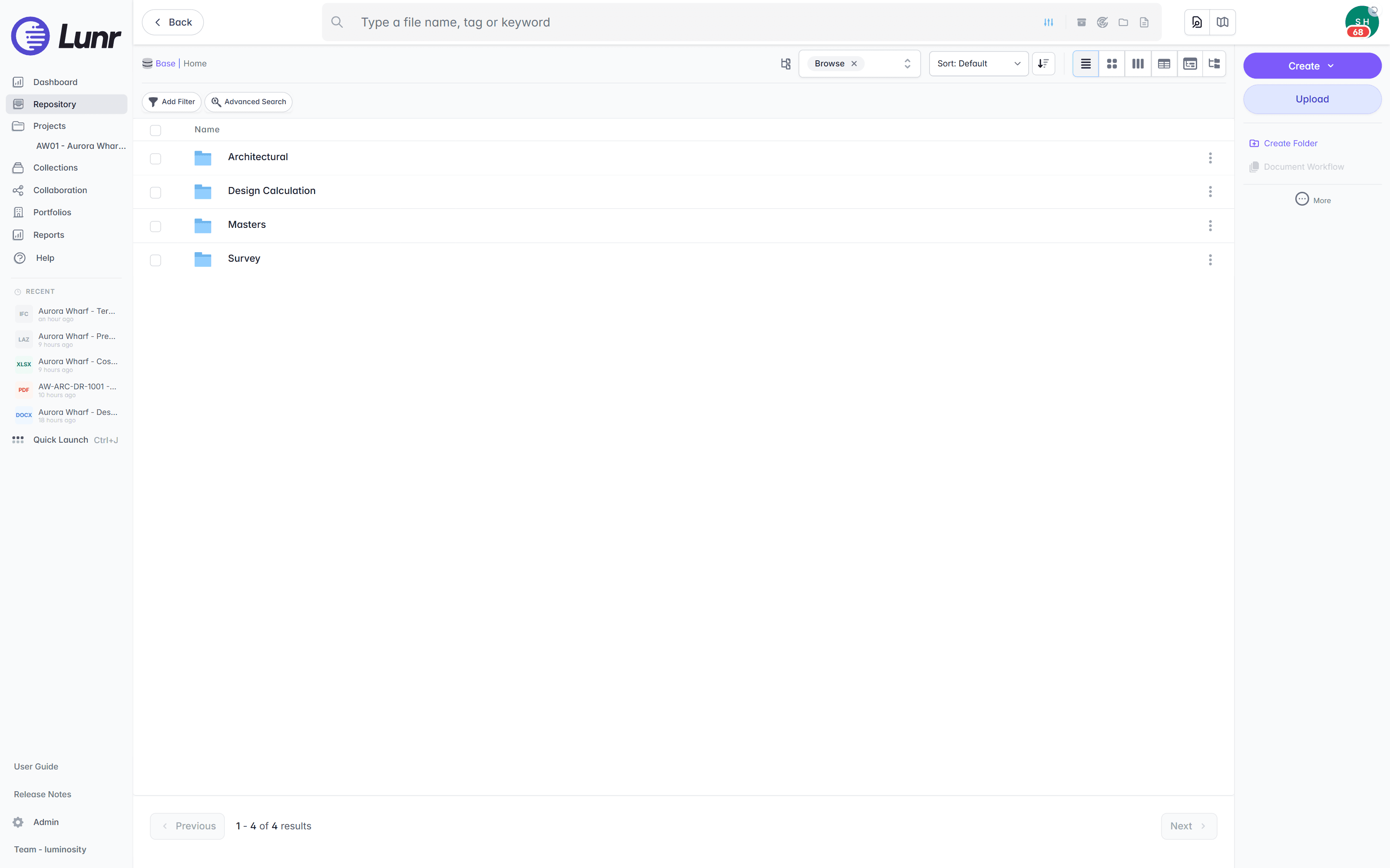
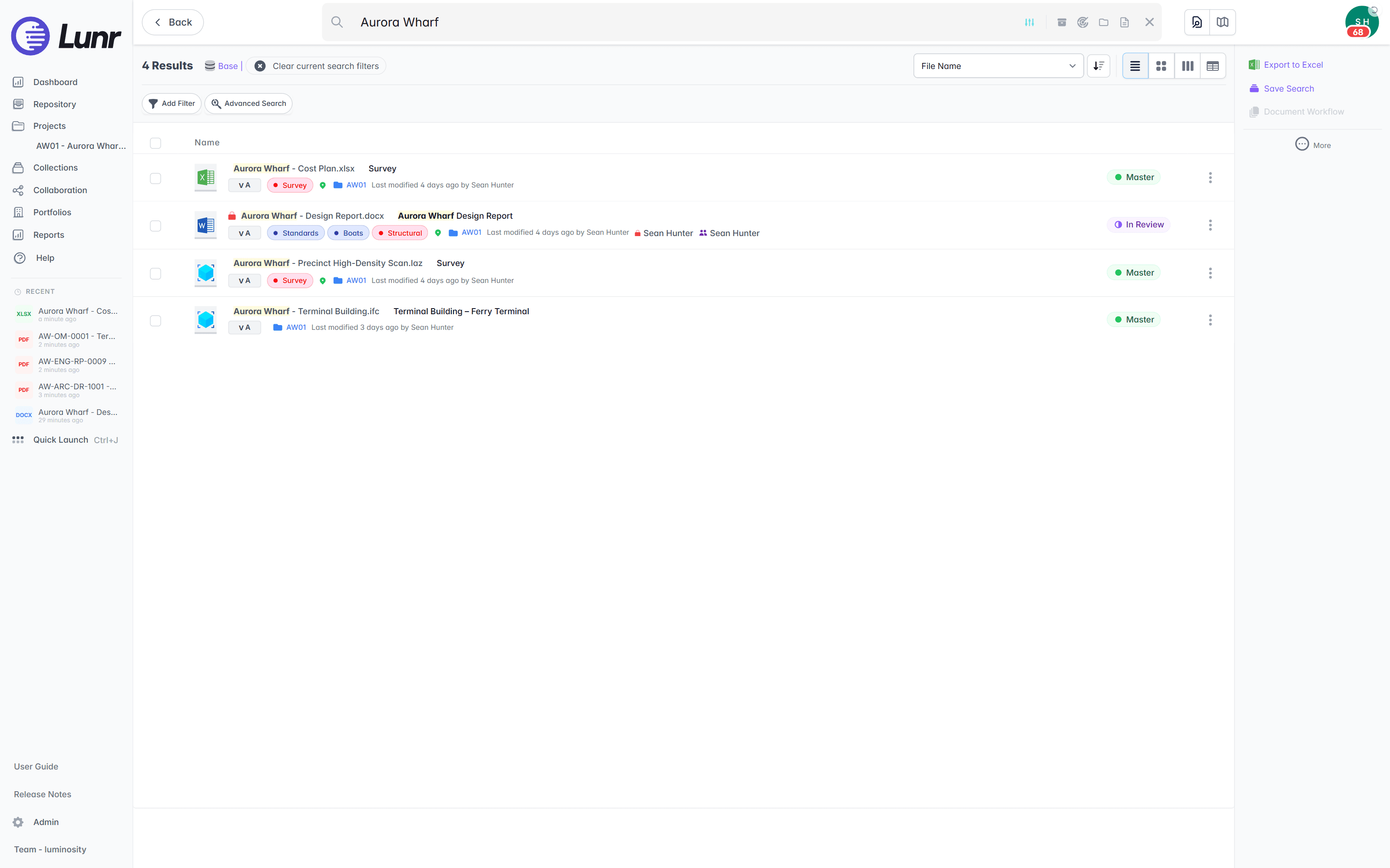
Search the plans, back through decades of inherited scans.
A council archive runs back to plans drawn long before CAD, inherited across amalgamations and staff turnover. XRAY runs OCR and full-text search across every drawing, scans included, so a lot number, a pit reference, or a note printed on a sheet is findable whether the drawing was saved this morning or scanned from a 1980s archive.
- OCR and AI full-text search across every DWG, DGN, RVT, PDF, and scanned image.
- Find a lot number, a pit reference, or a note printed inside the plan, not just the file name.
- Deep XRAY re-scans a dense sheet tile by tile, so nothing on the drawing is missed.
- Filter results by metadata, tags, and revision to narrow a large inherited archive fast.
OCR · AI full-text search · deep XRAY tile re-scan · metadata and tag filters
A small team sees the drawing without a CAD licence.
A council records or asset team is small, and most of the people who need a drawing do not run CAD. The Rift viewer renders DWG, DGN, and PDF at full fidelity in the browser, with layers, measurement, and markup, so records, asset, and works staff open a plan without a seat. Models open in Foundry, point clouds in Nimbus.
- View DWG, DGN, RVT, and PDF in the browser, with no CAD licence and nothing to install.
- Toggle layers, measure, and mark up the drawing straight in the viewer.
- Open BIM models in Foundry and point clouds in Nimbus from the same record.
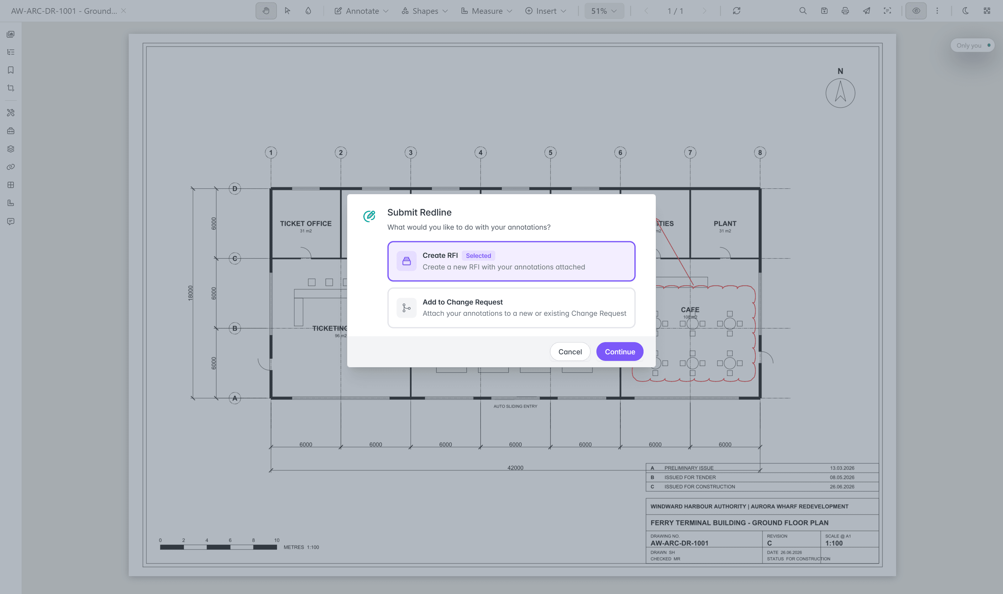
- Turn a redline into a change request or an RFI without leaving the viewer.
browser viewers · layers · measurement · markup · no CAD licence
Try the viewers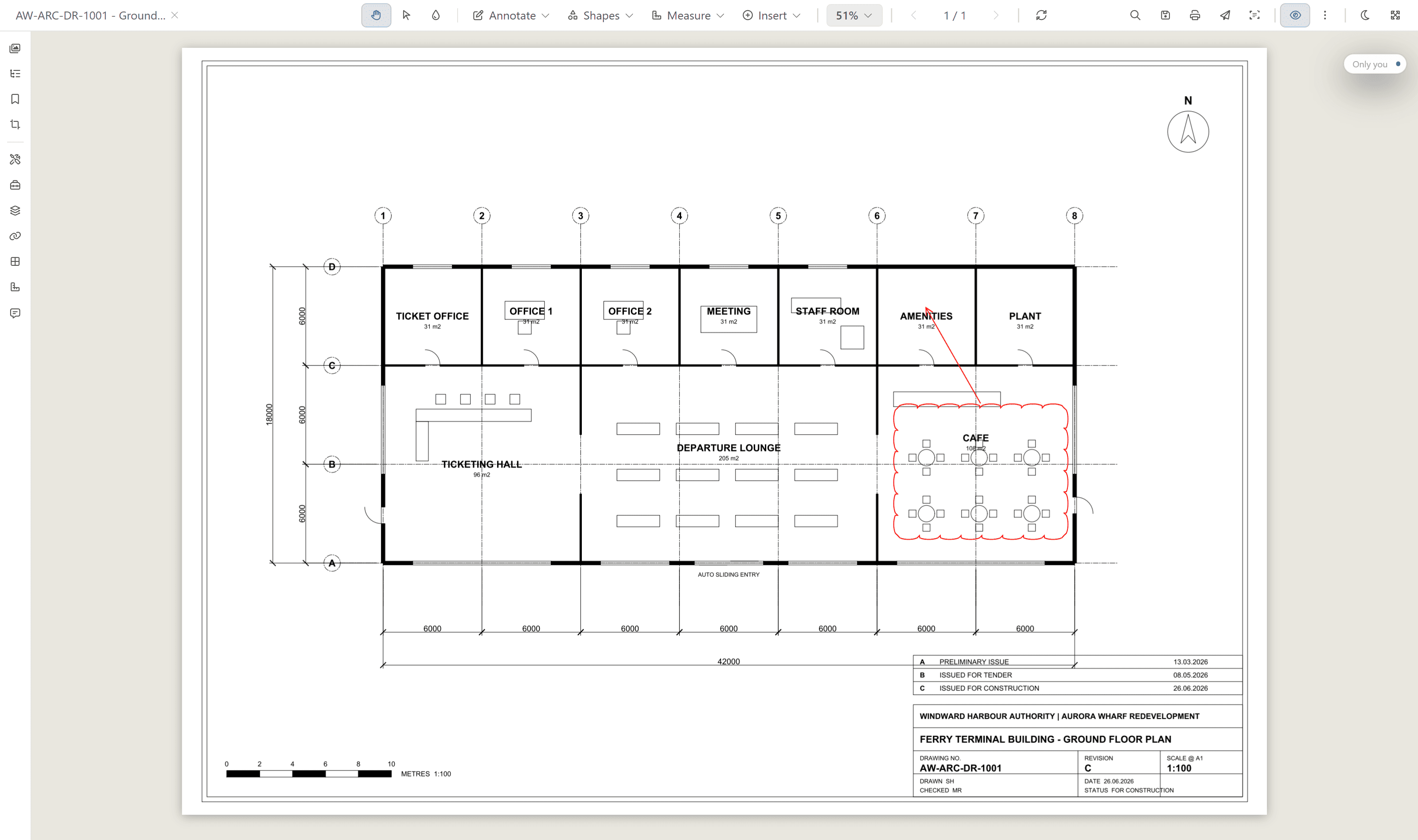
As-constructed sets that arrive complete.
Council works are delivered by contractors and consultants, and with a small team there is no one to chase a missing drawing months later. Validate each handover package against a manifest, so a missing as-constructed sheet is caught on upload, not discovered on the next job.
- Validate each handover package against a manifest, and read title-block tags into metadata.
- Issue tracked transmittals, and run change requests that hold, forward, and close.
- Move deliverables through configurable review and approval workflows.
- Contractors and consultants deliver as Collaborators, and see only what you grant them.
manifest validation · transmittals · change requests · configurable workflows · Collaborators
Open the drawing from the map of your roads and drainage.
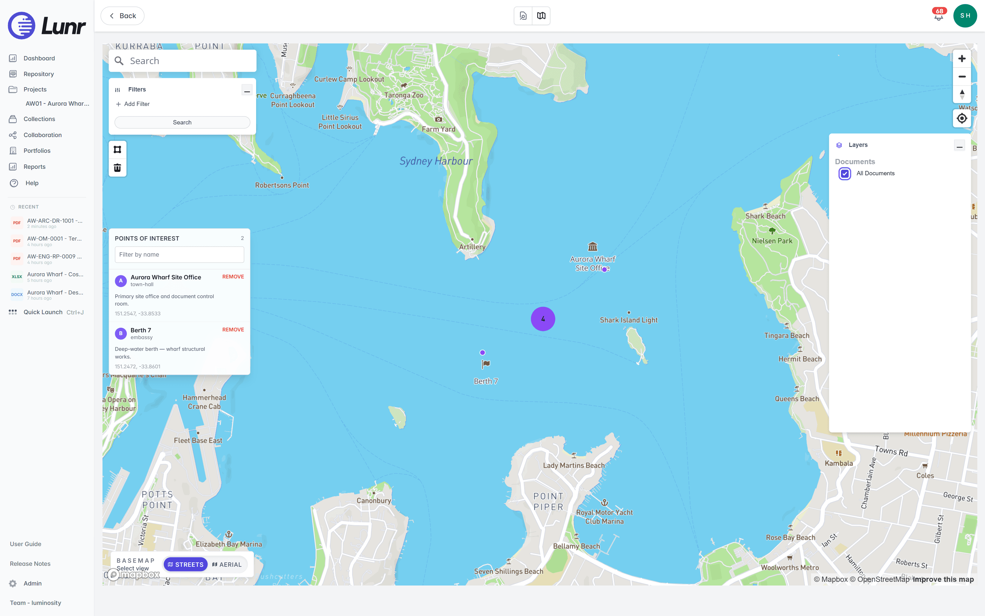
Roads, footpaths, and drainage are spread across the whole council area, and the map is where staff already look. The Esri and ArcGIS connector ties each drawing to its place on the network, so the engineering record opens straight from the map you run for roads, drainage, and reserves.
- Tie drawings to their place on the network through the Esri and ArcGIS connector.
- See every geo-tagged document on a live map, clustered by location.
- Draw a boundary around a suburb, a reserve, or a road corridor, and Lunr returns every document inside it.
- Browse the record from where you stand in the field.
Esri and ArcGIS · geo-tagged documents · polygon search · field access
Built to clear a council tender.
The answers a tender panel and a CISO look for are already in place. Pricing is shaped to your organisation, with every capability included as standard.
Data centres in Australia and the US. Your instance sits in the region you require, so records stay onshore.
Staff sign in with your identity provider. Contractors and consultants join as Collaborators.
Every controlled document carries a full revision history and audit log, ready for a public records request.
Export all metadata, drawings, and models at any time. The asset record stays with the council.
Every capability is standard, with pricing shaped to your organisation. Evaluation is fast, not a discovery project.
An accessibility statement is published and maintained for the browser workspace.
Read the accessibility statement, or connect the GIS, CAD, and asset management systems your council already runs on the connectors page.
Trusted with the record councils keep for decades.
A council keeps its record for the operating life of every asset. The University of Canberra shows the same discipline: it moved its archive off SharePoint and put it under control.
“Lunr is a simple solution that provides the flexibility to develop the system to our needs. Lunr is simple to use, and minimal training is required.”
10M+ documents under management on Lunr today.
Read the University of Canberra case studyQuestions councils ask about drawing management.
How the record is held today, where the data sits, and what it takes to bring an inherited archive across and keep it.
- How do councils manage engineering drawings today, and how is Lunr different?
- Most councils keep drawings in nested folders on SharePoint or a shared drive, split across teams and outsourced consultants. The current revision is a guess, superseded sheets stay in circulation, the text inside a scanned plan is invisible to search, and there is no audit trail. Lunr puts every drawing for your civic buildings, roads, and drainage under revision control in one register, keeps the superseded copy marked, searches the words printed inside each sheet, and logs every change. The University of Canberra moved more than 20,000 documents off SharePoint onto Lunr for this reason.
- Where is our data hosted, and does it stay onshore?
- Lunr is hosted in Australia and the US, and your instance sits in the region you require, so records stay onshore for data sovereignty. Staff sign in over SAML with your identity provider, contractors and consultants join as Collaborators, and every controlled document carries a full audit trail. Over 10 million documents are under management on Lunr today.
- We are a small team without CAD licences. Can staff still view drawings?
- Yes. Anyone with access opens DWG, DGN, and PDF drawings in the browser through the Rift viewer, with layers, measurement, and markup, and nothing to install. Models open in Foundry and point clouds in Nimbus. A CAD seat is only needed to author drawings, so records, asset, and works staff read the plan without one, which matters when the team is small.
- Can Lunr search our inherited archive of old scanned plans?
- Yes. XRAY runs OCR and full-text search across every drawing, scans included, so a lot number, a pit reference, or a note printed on a plan is findable whether the sheet was saved this morning or scanned from a 1980s archive. Deep XRAY re-scans a dense sheet tile by tile, so nothing on the drawing is missed, however many decades of records you have inherited.
- How does Lunr handle contractor handover and as-constructed sets?
- Validate each handover package against a manifest, so a missing as-constructed drawing is caught on upload rather than years later. Lunr reads title-block tags from every sheet into metadata, applies your register numbering as records come in, and issues tracked transmittals. The delivered set arrives complete and lands in the register the moment the contractor hands it over, so a small team has nothing to chase.
- Does Lunr work with our GIS, so staff open a drawing from the network map?
- Yes. The Esri and ArcGIS connector ties each drawing to its place on the network, so staff open the engineering record straight from the map they already use for roads, drainage, and reserves. Geo-tag documents, plot them on a live map, and draw a boundary around an area to return every document inside it.
See it on your own council drawings.
Book a walkthrough with someone who knows what a transmittal and an as-constructed set are, and we will map Lunr to your asset record.
10M+ documents under management · Hosted in Australia and the US · SAML · Full audit trail · Export anytime
- entity
- Lunr Labs Pty Ltd
- location
- Melbourne AU
- workspace
- documents.lunr.app
- rev
- 2026